
The part of forests in the Earth’s biodiversity has much to do with the planting, nurturing, cultivation, and science of trees, groves, bushlands, and wood thickets, which are the key species of forest ecosystems. The life and soul of our planet, forest ecosystems, make up for 31% of the world’s biodiversity. Being the only elemental source of air for other ecosystems, the sustainability of forests is immensely vital.
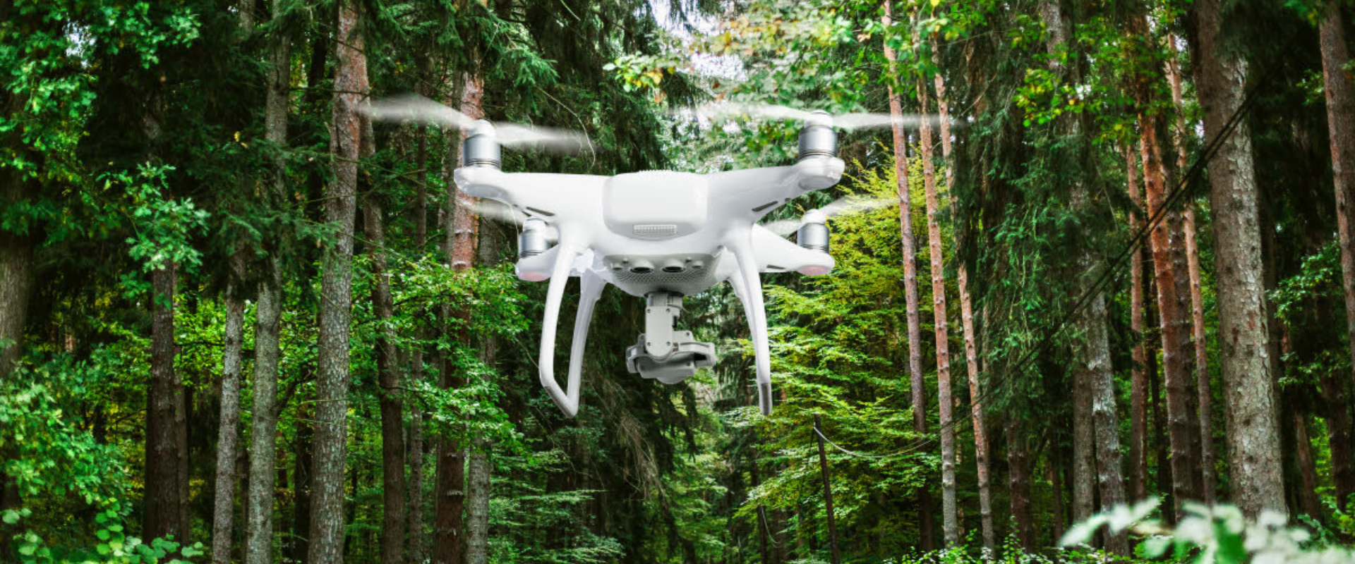
On the contrary, a great deal of the forestlands and timberlands have been witness to dangerous undertakings and their hazardous effects. As a means of relief, Unmanned Aerial Vehicles (UAVs) help in terms of aerial surveillance, mapping, aerial photography, thermal imagery, and topographic monitoring. Subsequently, this aids in wildlife conservation, biodiversity and vegetation conservation, the balance of ecology, and similar aspects of forestry.
Drones Helping Forestry
Like a potent robot of convenience and sheer proficiency, drone technology caters to the wide operations of the forest ecosystem to help maintain the balance of biodiversity. Reinforcing the virtues of nature, drone application in forestry has widened the scope of improvement, and the prospect of advancements throughout.
1. Emergency Situations
Drones, as employed for search and rescue missions, draw in the advantages of immediate relief in threatening situations. As a means of wildlife monitoring and biodiversity checking, UAVs prove to be highly resourceful at random times of distress and danger, which are frequent occurrences in forest ecosystems. Operations and tasks of delivery of emergency medication, surveying for harmful activities, immediate aid to ailing lives, etc., are a few instances of applications of drones in forestry that save time and hence, life.
2. Security and Reliability
Embodying the features of security and reliability, Unmanned Aerial Vehicles use their abilities to the limits to scan and cover the dense forest areas for potential harm or threats. Forest managers and officials may find it handy and skillful to adopt these winged aerial vehicles with their dependable qualities to survey and map regions with improved accuracy. This advances the level of efficiency of surveying and inspection and also recovers a fair amount of time, effort, and workforce.
3. Wildlife Monitoring
Regrettable to mention, but one of the greatest dangers of forests are the liabilities and perils to wildlife and biodiversity. Embracing its association with flora and fauna, forests have to be monitored to ensure the protection of the same. With the help of drones and UAVs, the balance of the ecosystem can be maintained, to better degrees. Aerial imagery, mapping, and data processing as performed by the AI-powered drones express endangerment alerts, scan for potential threats to wildlife, and so on. Time-critical results help to validate data and provide relief and medication in worsened conditions.
4. Forest Fire
Although completely eradicating the occurrences of forest fires are next to impossible, we sure can avoid it by miles. Menacing as they are, forest fires owe their devastating nature to more than one cause. By their speed and precision, drones can be used to scan the areas spanning the forests for potential threats of fires. The prior precautions lead to the prevention or immediate aid of the fires. Accounting for a major part of the forest ecosystem, animals, insects, and birds are also endangered by the harm that forest fires cause. Under their influences, UAVs aim to relieve these dangers and perils through their LiDAR sensors.
5. Vegetation monitoring and Disease Detection
Artificial Intelligence and Machine Learning fueling the drones have proved beneficial in the space of tree disease detection and prevention. LiDAR sensors in drones help accumulate and process data attributed to the wellbeing of trees, vegetation, and bushlands. Thermal imagery, topographic surveying, aerial mapping help locate diseased flora and navigate horticulturists and forest officials towards improving their conditions.
Applications of UAV in Forestry
Remote sensing using drones has a range of benefits such as reduced costs, flexibility in time and space, high accuracy data and the advantage of no human risks. It is important to mention that even though forest fires’ monitoring and management was one of the first field in forestry that showed the importance of drones in forestry, getting National Aeronautics and Space Administration (NASA) and the US Forest Service to present a drone that was able to fly up to 24 hours, at the moment the use of drones spread in other more popular forestry fields. The following will briefly present recent examples of applications of drones in forestry.
1. Mapping Forests and Biodiversity
An application in order to map forest areas was made by Koh and Wich [16], where a drone was used in mapping tropical forests in Indonesia.The experiment involved a small UAV type aircraft (under 1 kg) with a flight time range of approximately 25 min per flight and a maximum distance traveled per flight of about 15km. The acquired images were assembled after the flights and a land cover map resulted with a spatial resolution of 5.1 cm. Also, shots and videos that caught different human activities, logging, wildlife or flora species were made. Authors suggested that using UAV remote sensing can save time, costs and labor power.
2. Precisely Forest Management
Different parameters relating to forests such as the extent of canopy cover, the number of trees and volume estimation can also be achieved efficiently through the use of unmanned aircrafts. This data collected by use of drones are usually accurate and can help in quick and better decision making as opposed to other methods.
3. Mapping Canopy Gaps
Forest disturbances are mostly caused by wind and snow and these have a direct impact on the productivity of forest stands. This also affects regeneration. Satellite imagery was initially used to access this kind of data by mapping the canopy gaps but the information was not as accurate as it needed to be. This however changed with the introduction of drone remote sensing.
4. Capturing Forest Data
Drones can now be used to capture vital forest data such as the depth of snow in the forest, the canopy attributes such as canopy gaps and the extent of carbon storage within a forest. This information is not only relevant to forest researchers but also to forest farmers.
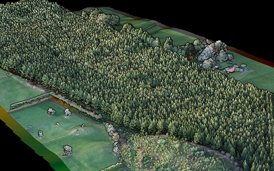
5. 3D Mapping (Carbon Storage)
In the past, measuring the extent of carbon storage in biomass has been very labor intensive and very expensive. But thanks to the introduction of drone technology, remote sensing can now be used to get 3D mapping of carbon storage within forests.
6. Tree Plantation with Drones
Planting trees in a forested area is not an easy task. The land is often not evenly distributed and it is sometimes inaccessible. Drones can be used to distribute seedlings in these areas in a fast and efficient manner and ensure trees are planted.
7. Saving Rainforests
Drones are now being used to do aerial surveys of rainforests to determine where the trees have been affected by human activities and the patterns being used to achieve this. Drones can then relay the data to the relevant authorities who use it to make informed decisions.
8. Illegal Quarry Monitoring
Drones can be used to monitor illegal quarrying especially in forested areas that cannot be easily accessible by humans. Drones can fly over these areas and take clear shots of the damage that has been caused in these areas and advise authorities on corrective measures to take.
9. Measuring Forest Stockpiles
Most companies are now using drones to measure stockpiles in the forests. Data on the number of logs, amount of sawdust and woodchips can now be easily determined at a much lower cost than it was before.
10. Forest Research
Some companies interested in forest research have employed the use of drones because they are cheap and save a lot of time. They can easily collect data related to the forests including the extent of the forest cover, forest attributes and so on.
11. Forest Security
A lot of forest cover is being lost to unscrupulous business people through logging and this ends up causing global warming. Law enforcement authorities have also employed the use of drones to do forest cover monitoring to arrest the people who are destroying them.
Check it out: “How Rayonier Foresters Use Drones to Manage Land” Click here
The Future of UAV Forestry
Redefining the elements of forestry, drone technology entails merits towards the progress and advancement of the forest ecosystems.
Drones, in this realm, push the boundaries of forest cultivation and maintenance, redeeming wildlife and vegetation, while also monitoring risks to prevent the felling of trees. With the adoption of drones, forestry can witness a high cascade of improvement and growth, like never before.
To Sum Up, The drone industry is expanding and therefore drones are finding their way into new industries. Drones can go where humans can’t, the possibilities of what drones can do for people, businesses and public safety are endless. Drones in forestry is a relatively new concept that is getting bigger by the day.
There’s a host of successes the forestry industry can achieve if the forest departments and companies implement drones into their operations, including further in-depth analysis through digital elevation models, monitoring harvest operations, and performing survival assessments and stream inspections. Drones are proving to be effective and relatively affordable forest management tools, and with more and more companies tapping into the technology, the future for the forestry industry looks bright.