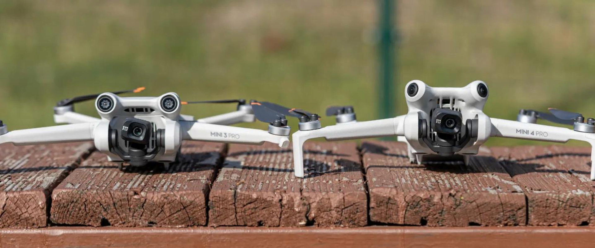
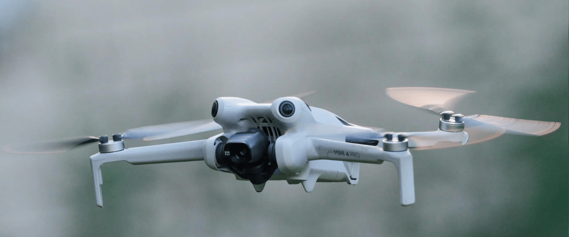
Blog - HobiTech

Call-us: +91 8660882500

India’s Leading Drone Marketplace – Trusted and Reliable!

Social Media Icons
Agriculture Drones

The Revolutionizing Impact of Agriculture Drones on Modern Agriculture

The agricultural industry is undergoing a profound transformation, driven by the integration of advanced technologies. Among these innovations, agriculture drones are proving to be game-changers, offering unprecedented capabilities for modern farming. At Hobitech.in, we explore how agriculture drones are revolutionizing the way farmers manage their crops, enhance productivity, and adopt sustainable practices. This article delves […]

Top 10 DJI Drones

Top 10 DJI Drones for Professional Photography in 2024

Introduction As drone technology advances, DJI continues to lead the industry with innovative designs and top-notch features. For professional photographers, DJI drones provide the perfect blend of high-resolution cameras, stability, and advanced flight modes. At Hobitech.in, we bring you the ultimate guide to the top 10 DJI drones for professional photography in 2024, helping you […]

DJI Avata 2

DJI Avata 2 Exploring the Future of Aerial Photography: A Comprehensive Guide

The DJI Avata 2 represents a significant leap forward in the field of aerial photography, marking a notable evolution from its predecessor. As an eagerly anticipated release, the DJI Avata 2 has generated substantial excitement among drone enthusiasts and casual users alike. Its arrival promises to redefine what is possible, pushing the boundaries of what […]

The Growing Impact of Agricultural Drones in India

The Growing Impact of Agricultural Drones in India

Introduction to Agricultural Drones Agricultural drones have emerged as a transformative tool in Indian farming, offering significant advancements in productivity and efficiency. These unmanned aerial vehicles (UAVs) are equipped with sensors and imaging capabilities that provide critical data to farmers, helping to optimize crop management and resource allocation. Enhancing Crop Monitoring One of the primary […]

DJI Drones in India

Unlock the Skies: Exploring DJI Drones in India and Elevating Your Aerial Experience

DJI drones in India Welcome to Hobitech Drones, your gateway to the mesmerizing world of DJI drones in India. Are you ready to soar to new heights and capture breathtaking moments from above? In this blog post, we will delve into the fascinating realm of DJI drones, highlighting their cutting-edge features, applications, and how they […]

UAV in Forestry

UAV in Forestry

The part of forests in the Earth’s biodiversity has much to do with the planting, nurturing, cultivation, and science of trees, groves, bushlands, and wood thickets, which are the key species of forest ecosystems. The life and soul of our planet, forest ecosystems, make up for 31% of the world’s biodiversity. Being the only elemental […]

Big Push for Drone industry: Budget 2022

Big Push for Drone industry: Budget 2022

OVERVIEW In many business activities, drones can substitute traditional methods of operation. This development comes after the Federal Aviation Administration expanded permissions for commercial, non-hobbyist usage of drones. With less human operation and no safety infrastructure, drones can reduce time and costs. The drone market will grow steadily in the consumer, commercial, and military sectors. […]

Urban Planning using Drones

As drone surveying lays a path toward well-established urban planning, we can quickly accumulate large amounts of real-time data. With extensive aerial mapping technology have benefited government agencies and private developers while designing and analyzing existing social and environmental concerns. Drones: A New Way Of Tackling India’s Urban Planning And Management Issue- Whether it is […]

UAV in Mining Industry

In the few decades, with the developing and advancing drone tech, the uses and applications of drones have been evolving into a wide range. When drones first emerged on the market, they were strictly used for military purposes. Today, drones are used in many ways including delivery of small items, industrial site inspections, infrastructure monitoring, […]

Aerial Survey

Aerial survey, also known as photogrammetry is a process of image acquisition of a surface from an elevated position. It is a method of collecting geomatics or other imagery by using airplanes, helicopters, UAVs, balloons or other aerial methods. Aerial Photography provides means of capturing important data required for civil engineering projects. Aerial photograph for […]

Free Pan India shipping

On all orders

Easy 7 days returns

Money back guarantee

Exclusive Full Protection Warranty

Offered in specially for india

100% Secure Checkout

Upi / MasterCard / Visa

Product Enquiry

Home
Drones
Search
Repair
Call us