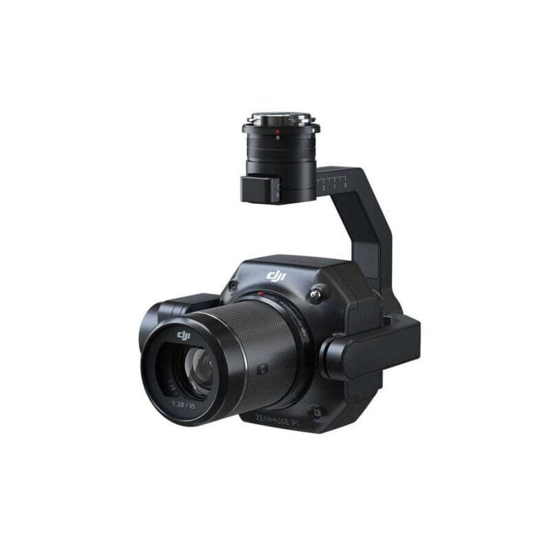
DJI Zenmuse P1 Drone Payload
The DJI Zenmuse P1 is a payload for aerial surveying and mapping; it equips high-resolution photogrammetry. With a full-frame 45 MP sensor, this payload captures highly detailed images suitable for accurate 2D maps and 3D models. It will feature support for interchangeable fixed-focus lenses (24mm, 35mm, and 50mm) and it will include DJI’s Smart Oblique Capture to allow for efficient large-area coverage. It will seamlessly integrate with the DJI Matrice 300 RTK, further increasing productivity with centimeter-level accuracy, real-time data acquisition, and high adaptability across various surveying missions including land development, urban planning, and environmental monitoring.
The drone weight of DJI Zenmuse P1 is engineered for professional work by photographing from the air and ensuring advanced characteristics, which guarantee high precision and efficiency in surveying and mapping. Here are some noticeable features:
Full-Frame 45 MP Sensor: This is the sensor size for the DJI Zenmuse P1 with a 45-megapixel lens that works to take pictures of ultra-high resolution which can be used for producing highly detailed maps and models in 2D and 3D. The large sensor also works better in low light which means the quality of data will be good in all conditions.
Smart Oblique Capture: The Zenmuse P1 incorporates Smart Oblique Capture. This is an innovation by DJI wherein the camera’s orientation is adjusted automatically to efficiently acquire oblique images. This minimizes the redundancy of images acquired, therefore hastening data processing while boosting productivity, particularly in large-area mapping projects.
Fixed Focus Lenses Swapping: The DJI Zenmuse P1 payload helps in swapping fixed focus lenses with 24mm, 35mm, and 50mm choices. This flexibility lets you select the best lens for various uses, be it precise urban pla͏nning, land survey work, or environ͏mental monitoring.
Integration with the Matrice 300 RTK: The Zenmuse P1 is to work with the DJI Matrice 300 RTK, providing kinematics for meter-level accuracy. The integration allows data collection and lowers the need for ground control points; it is good for surveying.
Mechanical Shutter: The DJI Zenmuse P1 drone payload comes with a global mechanical shutter wherein the speed is as high as 1/2000s. This guarantees pictures free from distortion, even at very high speeds of flight, enhancing the accuracy and reliability of photogrammetric data.
Workflow and Data Management: Optimized for quick acquisition and processing of data, the Zenmuse P1 supports a preview of images and quality control in real time as well as DJI Terra software to help in post-processing; this saves time on generating deliverables.
Adaptive Mission Planning: Versatile mission planning modes offered by the DJI Zenmuse P1 include corridor mapping and terrain-following, guaranteeing precise data capture in all types of terrains and landscapes. Such adaptability would increase the efficiency of the surveying projects.
High Endurance and Reliability: The Zenmuse P1 is built for long missions, up to 7.5 square kilometers in one go. Robust build plus weather resistance, plus always-reliable performance make sure that it can work effectively in challenging environmental conditions.
It is a fact that the DJI Zenmuse P1 drone payload represents a state-of-the-art solution when it comes to photogrammetry, integrating high levels of accuracy, efficiency, and flexibility to address the strict needs of professionals working on surveying and mapping projects.

Reviews
There are no reviews yet.