

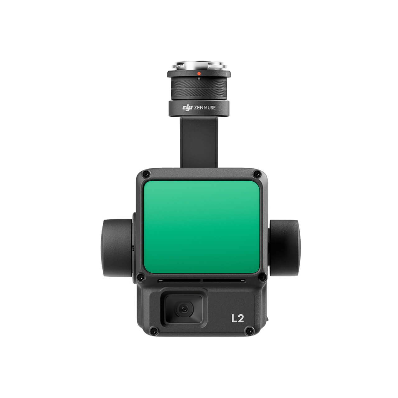


DJI Zenmuse L2 LiDAR drone payload
The DJI Zenmuse L2 is a LiDAR-enabled drone payload that is best suited for extremely accurate aerial surveys and mapping. Installed with advanced LiDAR technology, it creates point clouds at a higher density, plus very high accuracy in data collection, even in challenging environments. The L2 has a 3D scanning range of up to 450 meters and is fully compatible with DJI drones, which ensures facilitated real-time processing of data. Some of its most noteworthy features are the ability to see through vegetation and capture fine details, making it ideal for topographic mapping, infrastructure inspection, and forestry management. The Zenmuse L2 adds productivity to its high level of reliability and precision for professional geospatial applications.

The DJI Zenmuse L2 LiDAR drone payload is designed to give excellent accuracy in aerial surveying and mapping. Here are some features:
High-Density Point Cloud Generation: The DJI Zenmuse L2 LiDAR payload creates dense and detailed point clouds with up to 240,000 points per second; detail data for high-resolution work on mapping and modeling tasks.
Increased 3D Scanning Reach: With a scan reach of up to 450 meters, it can cover large areas efficiently, hence ideal for topographic surveys, forestry management, and infrastructure inspections.
Better Plant Penetration: The DJI Zenmuse L2 LiDAR can pass well through thick foliage and capture details at ground level, providing accurate data on elevation with contour maps even in challenging environments.
Seamless DJI Drone Integration: The Zenmuse L2 LiDAR payload is meant to be easy compatible and integrates smoothly with DJI drones like the Matrice series for real-time data collection and streamlined workflows in various applications.
Multiple Return Capability: The DJI Zenmuse L2 can support multiple return signals. This enables it to detect different surface layers in one scan which is very important for comprehensive dataset creation in complex terrains.
Highly Capable yet Lightweight and Compact: The Zenmuse L2 LiDAR payload is considered to be extremely lightweight and compact, thus easy to deploy in field operations without compromising the flight performance.
Data Processing and Analysis: It is accurate in detecting data with the ability to integrate DJI Terra and other post-processing software. The DJI Zenmuse L2 LiDAR drone payload ensures precise data processing for actionable insights into surveying, urban planning, and geospatial projects.
The DJI Zenmuse L2 LiDAR drone payload is made for pros who need trustworthy, top-notch info gathering in tough places, it gives easy setup, great results, and better work.


Reviews
There are no reviews yet.